Field Trips
Three core field trips, each aligned with a different theme of the workshop, have been developed for our delegates (Clyde Dam, Glenorchy, and Milford Sound). These will do more than teach you about the local geology and risks - they will form a core part of our workshop experience, being used to develop and test our ideas.
We also have two less formal field trips; a pre-conference hike, and a post-conference visit to see how landslides affect the vinyards around Queenstown.
Learn more about each one below.
We are hosting an informal networking event at the start of the week, so you can make new connections and re-connect with friends before the start of the conference. The event will be a hike up Queenstown Hill, allowing you to explore some of the stunning scenery around Queenstown while meeting other delegates attending the conference. The walk will also include a brief talk about Queenstown’s geology and geomorphology at the summit.
Please note that the event is open to all delegates, and everyone is welcome to attend (whether young professional or not).
If you are interested in attending the walk please email large2026@confer.co.nz or have any questions, please contact Christoph Kraus at ygp@nzgs.org.
- Field trip leader(s): Christoph Kraus
- Date: Monday 27 April
- Time: You can join the walk either at:
- 2:00 pm at the Millenium (conference venue) lobby, or
- 2:30 pm at the trailhead carpark, at 59 Belfast Terrace, Queenstown
- Number of spaces: Unlimited, and registration not required (but please email Christoph to help estimate numbers)
- Cost: Free
- Track distance and elevation gain:
- Distance: 5.4 km return (from Belfast Terrace)
- Elevation gain: 500 m
- Clothing: Weather in New Zealand can be changeable at very short notice. Please bring sunscreen, warm clothes and a waterproof jacket. Please wear sturdy footwear (e.g. hiking boots, or trail running shoes)
- Food and water: Food and water will not be provided. Please bring your own water bottle and snacks.
- More information: For more information about the trail please refer to:
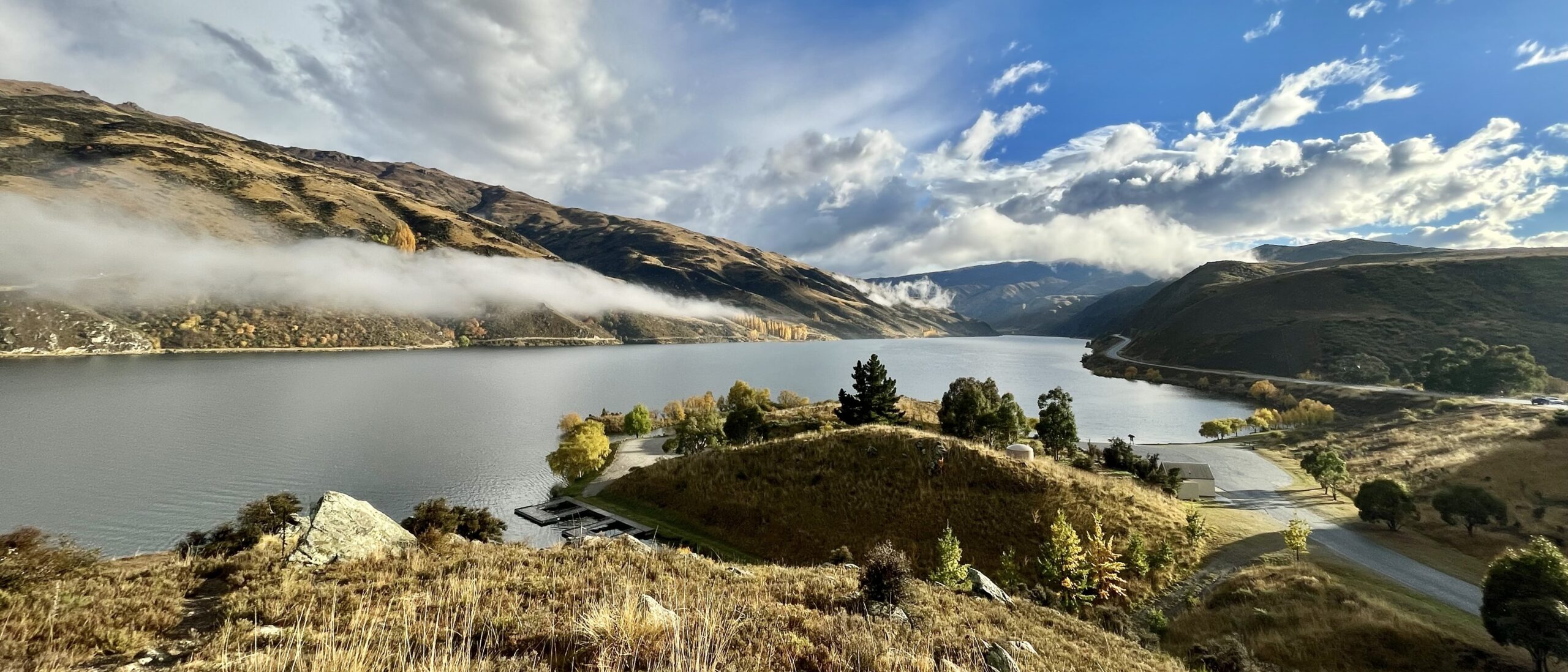
By AnnWoolliams - Own work, CC BY-SA 4.0, https://commons.wikimedia.org/w/index.php?curid=120134040
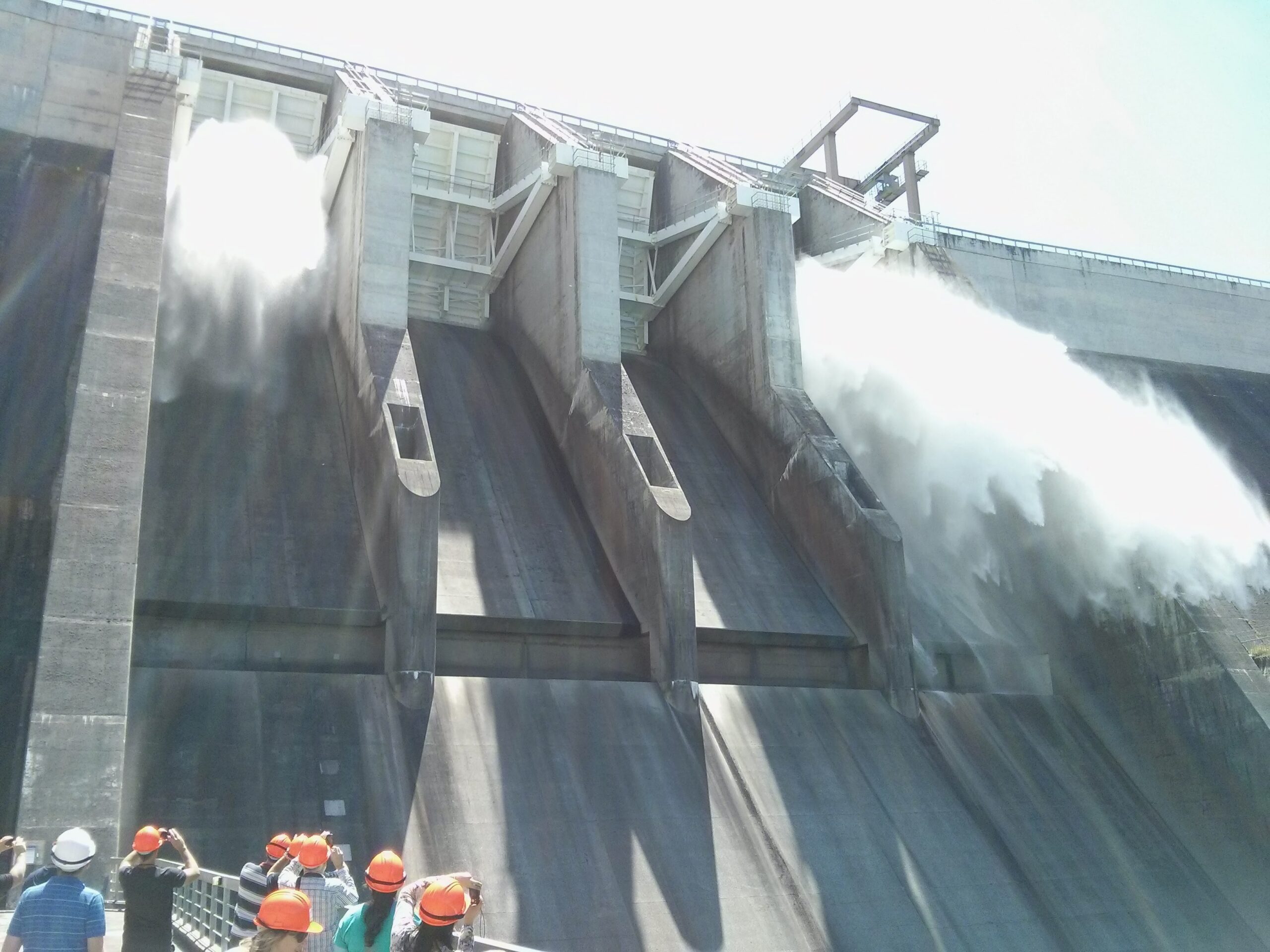
 With a focus on landslide investigation and remediation, this trip to the Clyde Dam will pass through Kawarau and Cromwell Gorges. The Clyde Dam started generating power in 1993, and was the last major hydro-electric scheme to be completed in New Zealand. It was a controversial project, with widespread opposition from local residents and environmentalists.
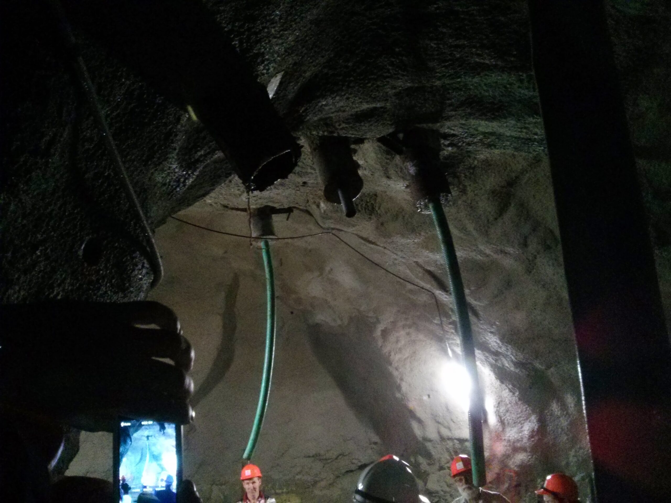
The presence of landslides in the Cromwell gorge had long been known and shown on geological maps but were not believed to pose major problems as they were thought to be ancient and inactive. The known landslides were monitored during the construction phase, and it was discovered that some ’dormant’ slides in the Cromwell gorge were slowly moving downhill. Exploratory drilling for a new highway led to the discovery of a complex, high-pressure groundwater system, and this led on to an extensive drilling programme on other landslides.
 A strategy was developed for a fast-track stabilisation program, based primarily on the use of tunnels for both investigation and drainage. All known landslides were re-mapped in detail, combined with drilling and tunnelling. Up to 40 geologists worked on the landslides over a two year period – it was the largest engineering geological investigation ever undertaken in New Zealand. Gravity drainage was the main method of remediation combined with grouting, buttressing, pumped drainage and continuous monitoring. Construction of the Clyde Dam took much longer than anticipated, with a final cost more than 45% above the original estimate.
This tour will include visits to the stabilised landslides showing the scale of work undertaken and sharing lessons learned, including deep drainage tunnels, slope reinforcement, infiltration management and monitoring. We will also explore the dam, including a tour into the innovate structure designed to withstand several metres of vertical displacement on the fault that runs directly through the centre of the dam.
- Field trip leader(s): Don Macfarlane, Romy Ridl
- Date: Tue 28 April
- Time: 07:45-18:40
- Number of spaces: 46
- Cost: $200 NZD
Buses will depart 15 minutes after the start time provided and will not wait if you are late.
Background information is available here:
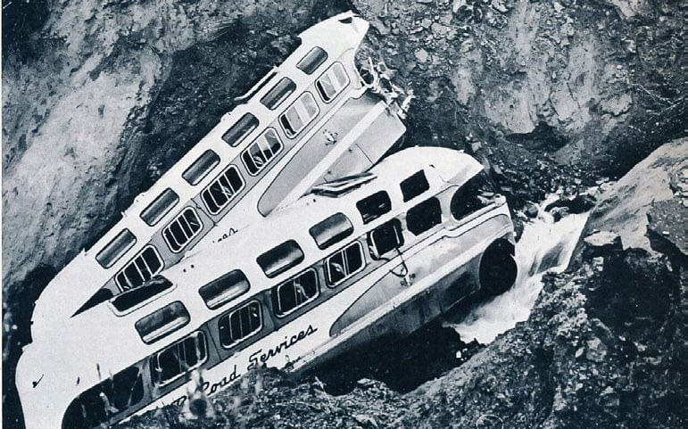
By Vladka Kennett - Own work, CC BY-SA 3.0, https://commons.wikimedia.org/w/index.php?curid=32905300
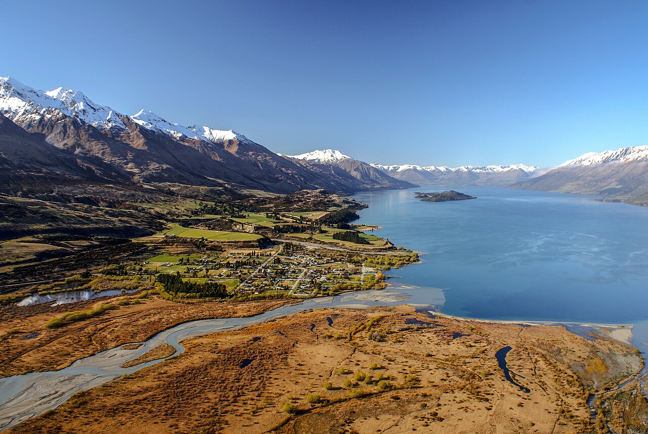
With a focus on education, natural hazard communication, and community resilience, this trip will visit the stunning village of Glenorchy. Surrounded by magnificent snow-capped mountains, Glenorchy sits a spectacular 45-minute drive from Queenstown.
Glenorchy’s soaring peaks, pristine lakes, glacial rivers, and ancient beech forests are a dream destination for outdoor adventures. Home to New Zealand’s finest hiking, the awe-inspiring scenery has formed the backdrop for films like Narnia, The Hobbit and The Lord of the Rings.
With this beauty comes risk. Glenorchy is directly exposed to hazard from flooding, earthquakes and liquefaction, and is very vulnerable to being cut off by landslides. In a large earthquake it would likely lose access to all major utilities. To manage these risks, detailed studies have been undertaken ranging from better understanding the hazard through to socio-economic impacts.
A natural hazards adaptation strategy was developed in partnership with the local community. This tour will investigate how the strategy was developed and is being implemented with the community.
- Field trip leader(s): Tim van Woerden, Anna Punt, Ann Conroy
- Date: Tue 28 April
- Time: 08:00-16:30
- Number of spaces: 47
- Cost: $200 NZD
Buses will depart 15 minutes after the start time provided and will not wait if you are late.
Background information
Background information is available here:
By Bernard Spragg. NZ from Christchurch, New Zealand - Milford Sound. Fiordland National Park. NZ, CC0, https://commons.wikimedia.org/w/index.php?curid=65803780
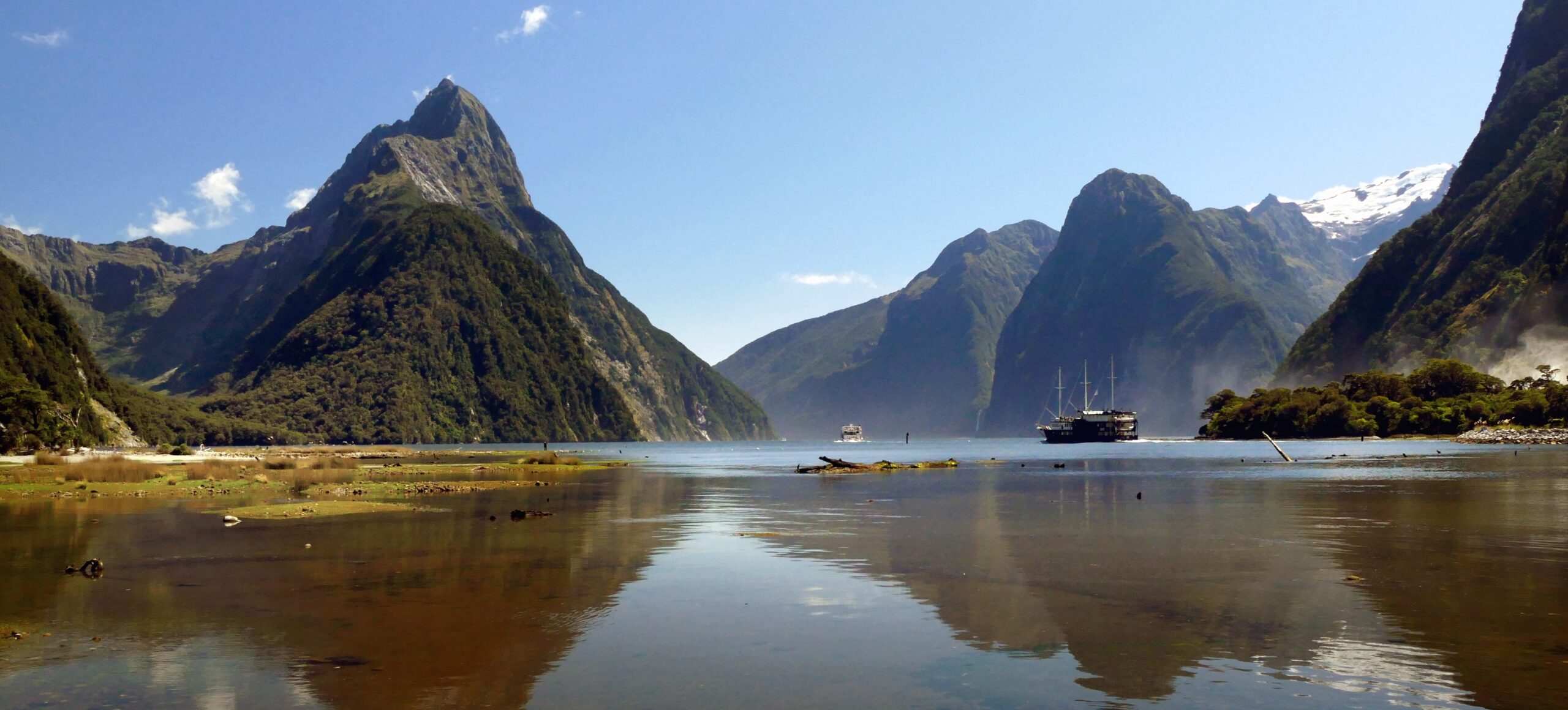
Deep within Fiordland National Park lies Milford Sound, New Zealand’s most stunning natural attraction. With its magical combination of mountain peaks, ink-dark waters and superb dramatic forest-clad cliffs, it must be seen to be believed.
It is also the only fiord in New Zealand that is accessible by road. However, its remote location, bounded by steep cliffs and dense rainforest, means its special features remain unspoilt. Rain or shine, Milford Sound continues to captivate even the most experienced traveller with its beautiful surroundings, ink-dark waters, gushing waterfalls and captivating views.
A million people a year visit Milford Sound. The nearby Alpine Fault ruptures, on average, every 330 years with a magnitude 8 earthquake, and this would likely cause a very significant rockslide. Geological evidence suggests that this has happed at least 30 times before. With only one route out, evacuation planning is extremely challenging.
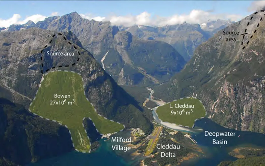 A recent Master's thesis has found a Milford Sound landslide-triggered tsunami may leave no survivors, with as many as 3500 dying if the wave hits during the peak of the tourist season. The best case scenario shows 5.2 percent of people would survive the wave, and in this case the tsunami would have to hit at night, during the winter offseason, when only a few hundred people would be in the area.
This field trip will explore the decision-making process required to balance the public interest in visiting this natural wonder with the potential risk it poses.
- Field trip leader(s): Tom Robinson
- Date: Tue 28 April
- Time: 06:00-20:00
- Number of spaces: 47
- Cost: $650 NZD
Buses will depart 15 minutes after the start time provided and will not wait if you are late.
This spectacular tour includes a cruise and a long bus journey.
Background information
Background information is available here:
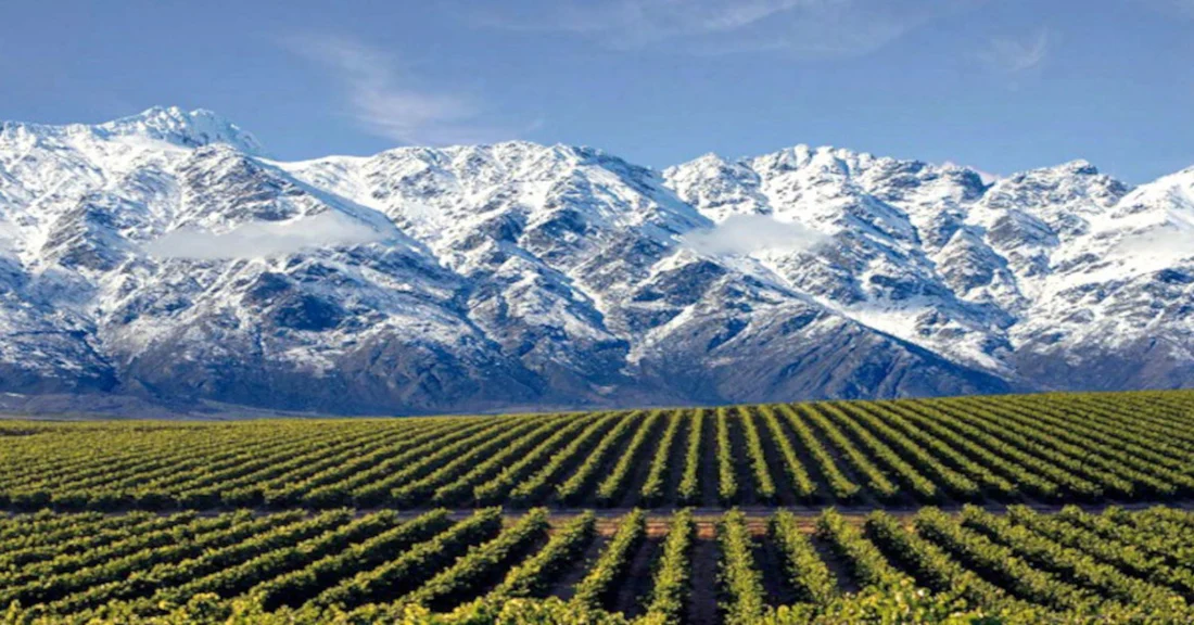
Image courtesy of Aroha Wine https://arohawine.com/blogs/regions/central-otago
This informal post-workshop field trip will take you on a relaxed journey to some of the best vinyards near Queenstown. With many located on significant landslides, you'll hear about the impact of the landslides on the grapes and the wine.
All of the main winegrowing subregions lie within close reach, with the distinctive mountainous terrain providing each with a unique climate, aspect and altitude.
Pinot Noir flourishes in the Central Otago, with a variety of stunning expressions being crafted in the numerous subregions. Lauded for its complexity, Pinot Noir reaches its peak potential in a semi-arid climate with hot days and cold nights. Central Otago is just such a place, with temperature changes of 20+ degrees in a single day over the growing season. The hot days give plenty of heat for the vines to photosynthesise and respire, but the cool nights slow down the ripening allowing the grapes to develop complexity and depth. Low rainfall contributes to keeping the bunches small and berry weights down, resulting in exceptional concentration of flavour.
The region is also renowned for producing excellent Chardonnay and Aromatics.
- Field trip leader(s): Chris Massey, Ian Hamling
- Proposed date: Sun 3 May
- Proposed time: TBC, likely mid-day to mid-afternoon
- Number of spaces: 47
- Cost: $250 NZD
Full details are to be confirmed. Note that this field trip is on a different day to the other three trips, so it can be booked in addition to those.
We aim to visit two vinyards, where there will be talks by local experts alongside tastings. We will endeavor to enable an early return to the airport for people who need to catch a late afternoon flight. We will contact you closer to the event to identify people who need to leave early. This field trip is unlikely to be suitable for people who have a flight before 16:30.
Further information
Find out more about Central Otago Wine here: https://www.centralotagowine.co/